James Corner, internationally renowned landscape architect and forerunner of the landscape urbanism movement, was author in 1996 of “Taking Measures Across the American Landscape“, an exploration of American types of landscapes through essays and map drawings by Corner and aerial photos taken by Alex McLean.
“(The book) investigates the ways in which landscape representation–particularly aerial vision–not only reflects a given reality but also constitutes a way of seeing and acting in the world. It discusses the many meanings of measure–from practical (such as solar furnaces in California) to poetic (such as raised tablets in Illinois that once formed the structure of an ancient city). And it suggests alternative possibilities for planning and taking future measures in our environment, building upon examples that range from the rectilinear survey landscape to the great transportation networks and such technological innovations as windmill fields, pivot-irrigation systems, and radio-telescope installations.”
From the Yale University Press page about the book.
Already (partially) blogged on Socks.
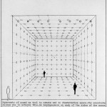
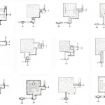
These are some of the drawings contained in the book, (and two others) thanks to RNDRD:


Il libro è stato mai tradotto in italiano?
we’re sorry we don’t know