After actually visiting the 14th International Architecture Exhibition of la Biennale di Venezia, during the last week, we finally had the pleasure to discover (and understand) some installations we have neglected in our previous virtual visits to this year’s exhibition.
One of these is “Italian Limes“, a reserch and installation work hosted in the Monditalia section at the Corderie dell’Arsenale, conceived and designed by Studio Folder (Marco Ferrari and Elisa Pasqual), with interaction designer Pietro Leoni and in collaboration with photographer Delfino Sisto Legnani, Dawid Górny, Alex Rothera, Angelo Semeraro for the projection mapping and Alessandro Mason + Claudia Mainardi for the production coordination.
The extremely intelligent installation moves from a research project of the authors around the geo-political, economic, legal and logistical notions of the border, through the technological analysis of its changing due to global warming in the specific context of the Alps and, in particular, in a section of the Similaun glacier.

The Alpine confine between Italy and the adjacent countries is not, as you may guess, a fixed border, historically subjected to territorial negotiation or warfare re-definition, but, in fact, a variable line defined by international relations as well as geographical and environmental conditions (namely: the decreasing height of the glaciers).
Not only the physical evidence of the border has changed according to the technological evolution of the systems of measurement and control (from the invention of “photogrammetry in the late 19th century“, to “the first aerial surveys during WWI and, more recently”, from “the materialisation of trigonometric networks” to the “the hyper-precision of satellite-based GPS“), but the same nature of the confine changed according to the political interactions between confining countries:“The angular peaks of the Alps displayed a misleading visual consistency: from West to East, in fact, they negotiated vastly disparate terms of exchange, from the seamless interfaces with NATO-allied France and Austria, to the economical and political enclave of Switzerland, and finally to the restrictive border with the former war-torn Yugoslavia and the southern tip of the Iron Curtain. After the signing of the Schengen Agreement in 1995, the primary mountain passes have evolved from political filters into infrastructural channels, governed by EU regulations, market standards, and logistical performance.”
As the watersheds (which define large stretches of the borders) are increasingly shrinking due to climate change, Italy was forced to negotiate, between 2008 and 2009, the definition of the boundary with Austria, France and Switzerland, introducing the unprecedented concept of “mobile border” into national legislation, “thus negating the possibility of determining its own boundaries with certainty“. The adoption of ultra-precise physical GPS trackers allows experts from Italy and foreign countries to retrace the entire course of the Alpine borderline every two years.
From the project’s description by Marco Ferrari on Klat Magazine (that we suggest to read in its entirety):
This story—apparently of no relevance to our daily lives—immediately prompted a broader reflection on the dynamics of contemporary geopolitics. It highlights the provisional nature of any boundary condition, the fact that natural frontiers are subject to changes brought about by environmental processes and, finally, how technology influences the way we think and operate at every level today.
In order to communicate the results of the investigation, the authors created an installation which would be easily accessible by the Biennale’s visitors of the Corderie dell’Arsenale. They choose a 1,5 km stretch of the border passing through the Similaun glacier (about 3330m above sea level) and installed five solar-powered GPS sensors “along the borderline determined by the most recent official measurements made by the IGM in the summer of 2012. Once an hour, the GPS sensors transmit their geographical coordinates to a remote server by satellite link.”


Photo by Marco Ferrari (May 2014)
From Klat Magazine: http://www.klatmagazine.com/architecture/italian-limes-01-confini-mobili-sulle-alpi-biennale-architettura-2014/13858
Despite its intrinsical technical and logistical complexity, the installation ends up looking impressively elegant and consistent in the actual Venice exhibition.
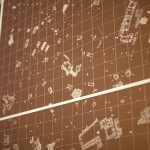
Three elements are laid out in a line: a 1:3000 model of the Similaun glacier in the analyzed stretch, onto which an animation showing the changes in the position of Italian border is projected; a collection of previously unpublished documents from the archives of the IGM (Istituto Geografico Militare), comprising photos, maps and the evolution of the techniques and instruments used by people to measure and maintain the border; and, finally, “a drawing machine: an automated pantograph controlled by an Arduino board and programed with the Processing language—able to convert in real time the coordinates received from the GPS sensors into a representation of the shifts in the borderline. It functions autonomously and can be activated on request by any visitor, who will therefore be able to take away a map—different on each occasion—of a section of the boundary between Italy and Austria, created at the exact moment of the visit to the installation.”


Photo by Mika Savela
http://mikasavela.tumblr.com/post/94143335439/monditalia-at-the-arsenale-is-one-of-the-2014


Italian Limes, deservedly recipient of a special mention award and on display in the Corderie dell’Arsenale of the Venice Biennale until November 23, 2014, is a powerful tool which reveals “how the Alps have been a constant laboratory for technological experimentation, and how the border is a compex system in evolution, whose physical manifestation coincides with the terms of its representation.”
Further reading:
Italian Limes press release
Moving Frontiers in the Alps, an article on Klat Magazine (ita/eng)
Where Borders Melt (BLDG Blog)
Mika Savela’s beautiful commentary on Italian Limes.
Related:
Our boundaries move (Federal Office of Topography)
Paolo Giaccaria, “Confine → Soglia”, in P. Perulli (a cura di), Terra mobile. Atlante della società globale, Einaudi, Torino 2014;
Barry Smith, Achille C. Varzi, “Fiat and Bona Fide Boundaries”, in Philosophy and Phenomenological Research, 60:2 (2000)
Follow Italian Limes on Twitter.
All photographs © Delfino Sisto Legnani, (June 2014) unless when otherwise noted.


Leave a Reply