SOCKS

An online magazine of Art, Architecture, Media, Culture, Sounds, Territories, Technology)

  • Media
  • Art
  • Architecture
  • Culture
  • Sounds
  • Territories
  • Visual Atlas

Taxonomies of Transition: Urban Segregation Maps by Bill Rankin and Eric Fisher

January 22, 2012 by Fosco Lucarelli Leave a Comment

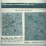
“A taxonomy of transition“, (2009) by radical cartographer Bill Rankin is a visual essay on how racial boundaries mark the neighborhoods of a city like Chicago, “where the delimitation of (…) official “community areas” in the 1920s was one of the hallmarks of the famous Chicago School of urban sociology.”

This work uses dot mapping to show populations (Red/Purple is White, Blue is Black, Green is Asian, Orange is Hispanic, Gray is Other, and each dot is 25 people), hence describing three kinds of urban transitions: stark and precise boundaries, transitions and gradients, gaps.

This project was originally published as an essay in the Spring 2010 issue of Perspecta, the journal of the Yale School of Architecture.

In 2011 it won the MiniMax mapping contest at the “Moving Maps” cartographic biennale in Lausanne, Switzerland.

Astounded by Bill Rankin’s map of Chicago‘s racial and ethnic divides (above), Eric Fisher tried the same kind of mapping on 40 American cities. See here his “Race and Ethnicity” photoset, particularly because high definition images allow an for a better vision of the transitions.

Washingron D.C.: a strong separation between East and West;

Detroit: 8 mile beltway, providing a boundary for Black and White populations;

San Francisco Bay: white predominance over Northern side of the city, while relatively better integration on other sectors of the Bay;

New York: extreme racial segregation, increased by massive density. Possible cross-cultural ferment on boundaries;

LA: low density allows for blending neighborhoods;

San Antonio: even integration between white and hispanic populations.

Via: FastCo Design

Related Posts

  • A False Paris Outside Paris: a ‘City’ Created to be Bombed

    With exactly the same title, on 6 November 1920, the story of Sham Paris was…

  • The Diesel Era Lithographs of Louis Lozowick (1920's to 1940's)

    The Diesel era immortalized in the powerful lithographs of Louis Lozowick (December 10, 1892 – September…

  • Mas Yendo Speaking of Himself

    Two days ago Socks featured the work of Mas Yendo. Thanks to Stefano Massa (@doctorcrowd…

  • Salaryman 6 - A Modern Tale of Overwork in Japan

    Salaryman #6, a short 2002 movie, is a tale of modern life in Japan. A…

  • Book Review: Pamphlet Architecture 11-20

    Pamphlet Architecture is a Princeton Architectural Press publication founded in 1977 "as an alternative to…

Leave a Reply

Your email address will not be published. Required fields are marked *

  • Instagram
  • Twitter
  • Facebook
  • Tumblr

Socks is a non-linear journey through distant territories of human imagination.

About | Visual Atlas | Topics

We are Mariabruna Fabrizi and Fosco Lucarelli from Microcities. Ask us anything

  • Instagram
  • Twitter
  • Facebook
  • Tumblr


SOCKS is a project by Fosco Lucarelli and Mariabruna Fabrizi of MICROCITIES, Architecture Cityscape, Landscape.
Except where otherwise noted, the content on this site is licensed under a Creative Commons Attribution-ShareAlike 3.0 license.
Whenever possible we try to attribute content (images, videos, and quotes) to their creators and original sources. Please feel free to write us if you notice misattributions or wish something to be removed.
SOCKS is powered by WordPress.