SOCKS

An online magazine of Art, Architecture, Media, Culture, Sounds, Territories, Technology)

  • Media
  • Art
  • Architecture
  • Culture
  • Sounds
  • Territories
  • Visual Atlas

How the World was Imagined: Early Maps and Atlases

June 10, 2012 by Fosco Lucarelli 8 Comments

Depictions of the world from the Iron Age to the Age of Discovery and the emergence of modern geography during the early modern period.

(Informations and images from Wikipedia)

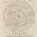
update: due to an excess of page views for this particular post, we are obliged to reduce temporarily the big images in a preview gallery. Click on the thumbnails to open the original size files


Click titles for further details:


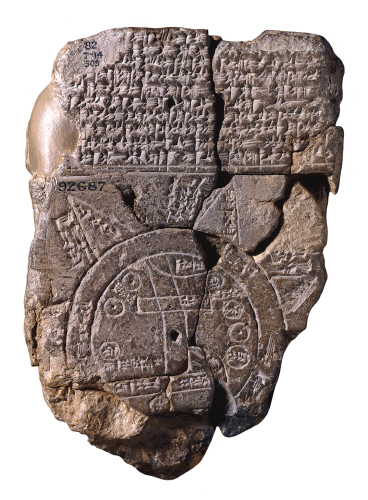
Babylonian Imago Mundi (c. 600 BCE)

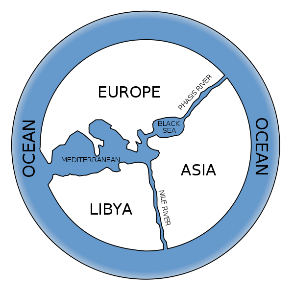
Anaximander (c. 610 – 546 BCE)

Hecataeus of Miletus (c. 550 – 476 BCE)

Eratosthenes (276 – 194 BCE)

Posidonius (c. 150 – 130 BCE)

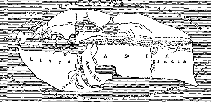
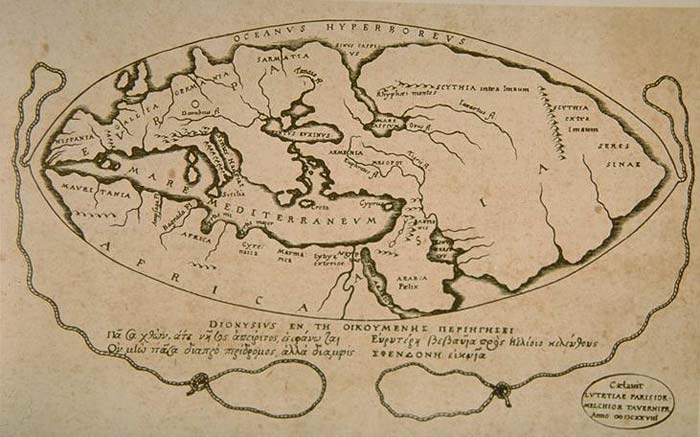
Strabo (c.64 BCE – 24 CE) (See also: Strabo’s Geographica)

Pomponius Mela (c. 43 CE)

Marinus of Tyre (c. 120)

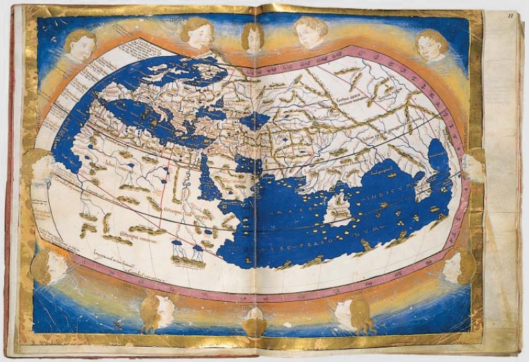
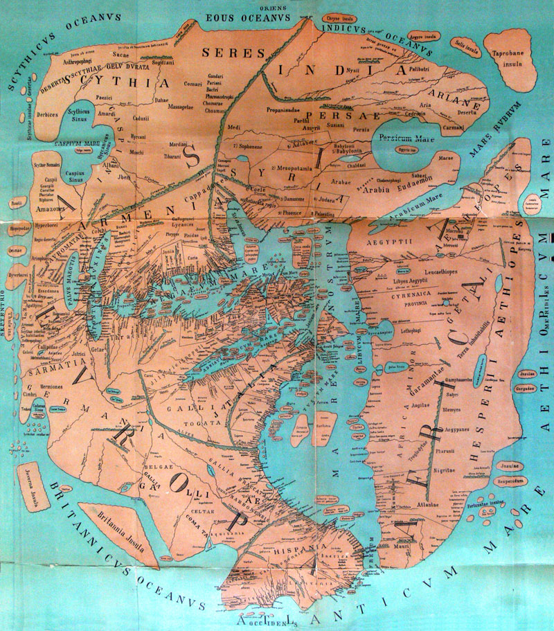
Ptolemy (c. 150) (See also: Ptolemy’s Geographia)

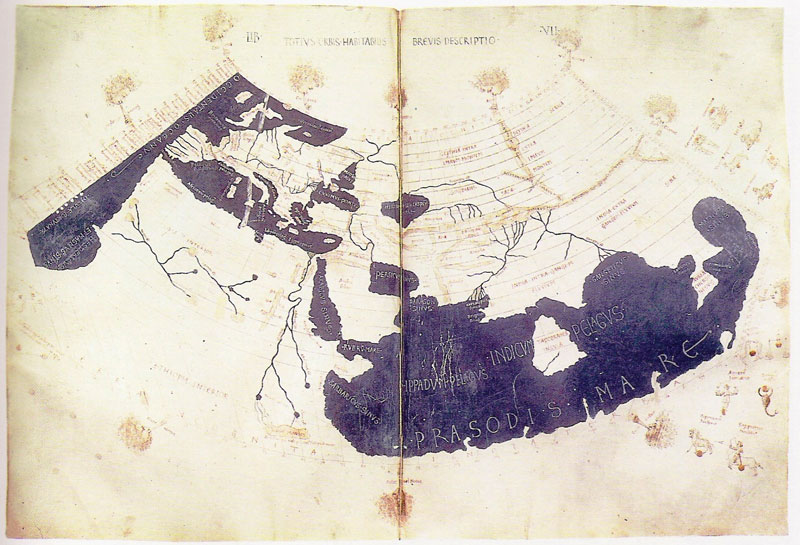
Tabula Peutingeriana (4th century)

Cosmas Indicopleustes’ map (6th century) (See also: Cosmas Indicopleustes’ Christian Topography)

Isidore of Sevilla’s T and O map (c. 636)

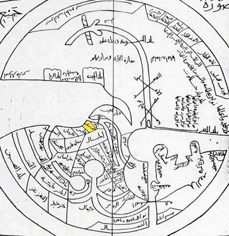
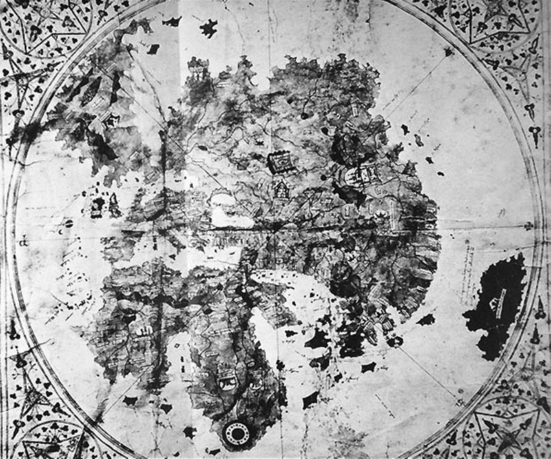
Ibn Hawqals map (10th century)

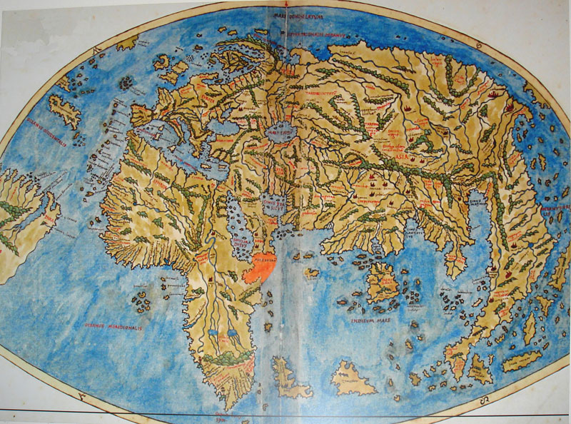
Anglo-Saxon Cotton world map (c. 1040)

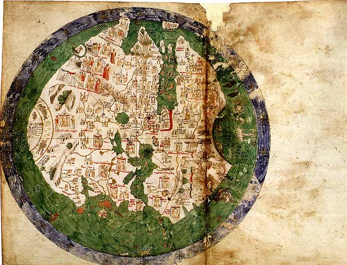
Beatus of Liébana’s Mappa Mundi (1050)

Mahmud al-Kashgari’s map (1072)>

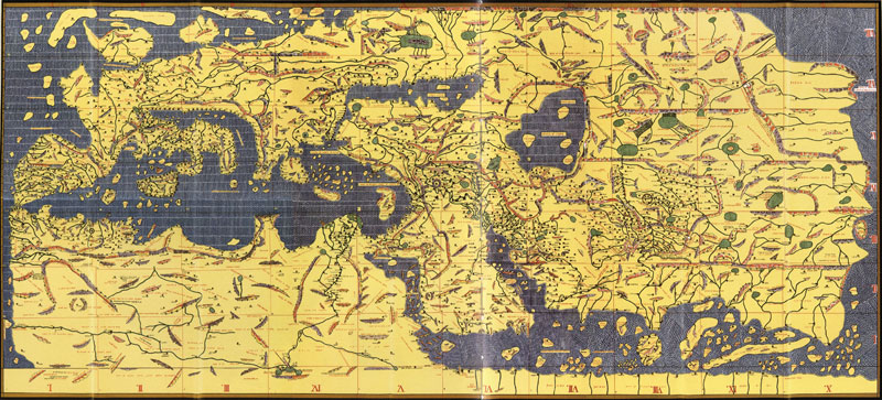
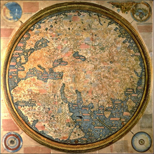
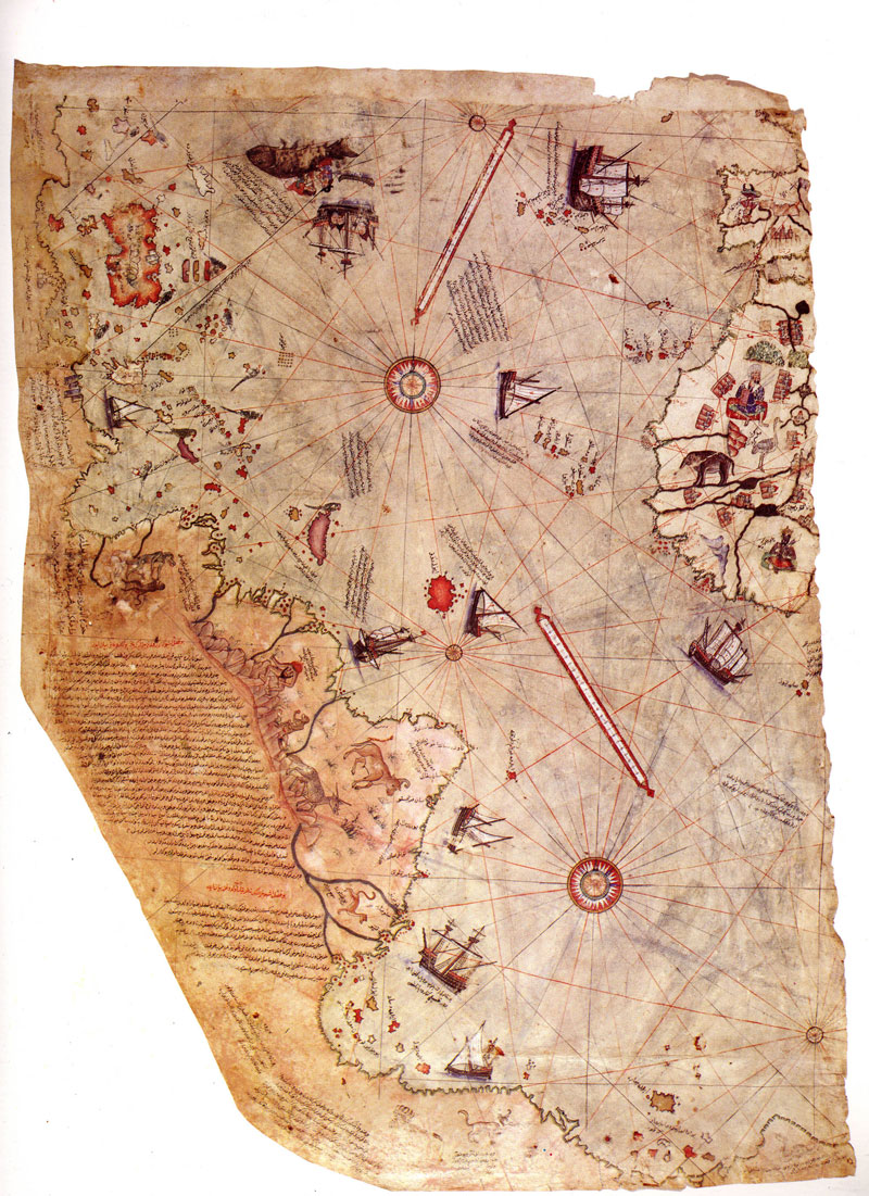
Al-Idrisi’s Tabula Rogeriana (1154)

Ebstorf Mappa Mundi (1235)

Hereford Mappa Mundi (1300)

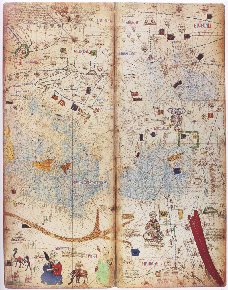
Pietro Vesconte’s world map (1321)

Catalan World Atlas (1375)

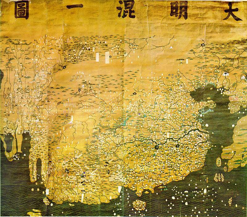
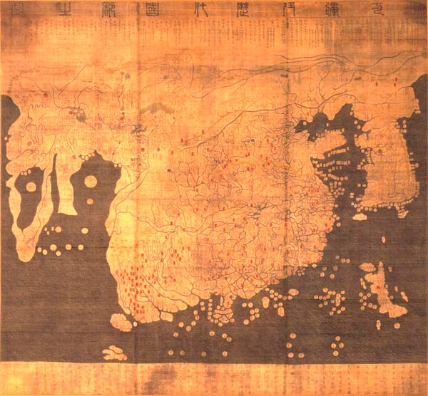
Da Ming Hun Yi Tu world map (1389)

Kangnido world map (1402)

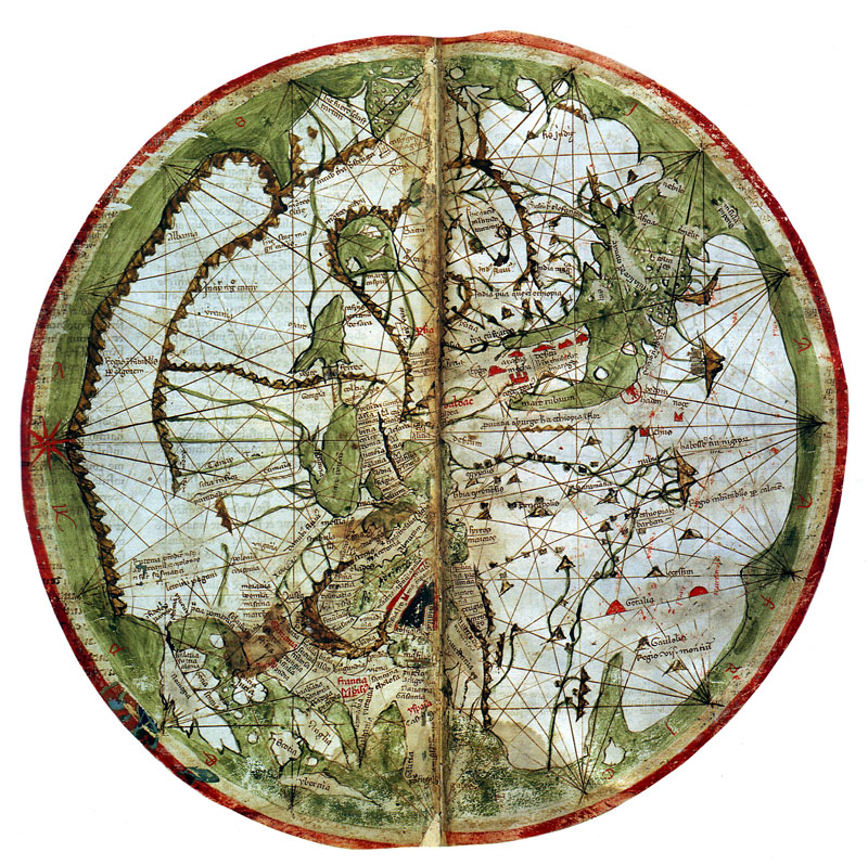
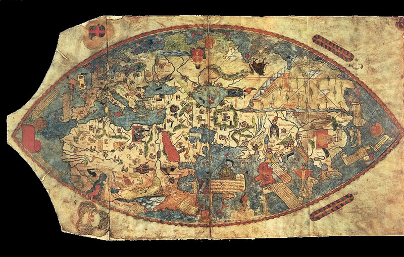
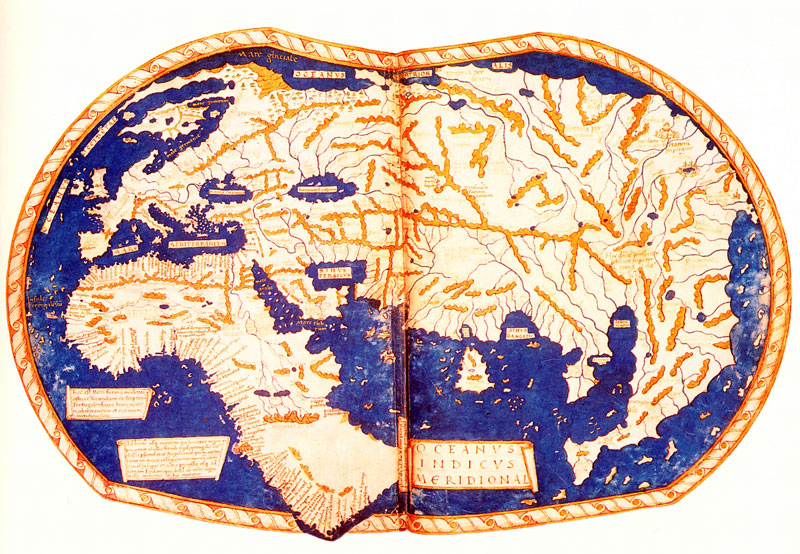
De Virga world map (1411-1415)

Bianco’s world map (1436)

Genoese map (1457)

Fra Mauro world map (1459)

Martellus world map (1490)

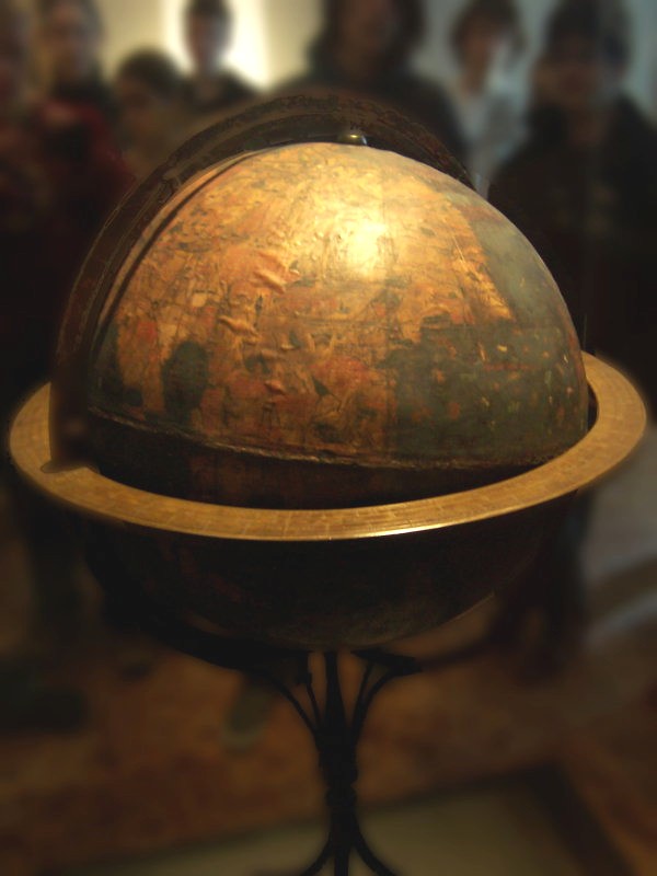
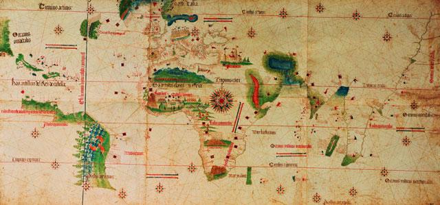
Behaim’s Erdapfel globe (1492)

Juan de la Cosa map (1500)

Cantino world map (1502)

Caverio Map (c.1505)

Ruysch World Map (1507)

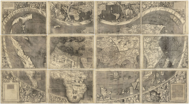
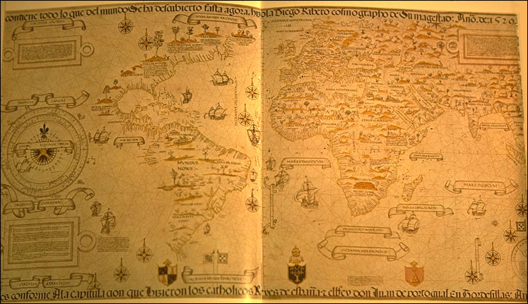
Waldseemüller and Ringmann map (1507)

Piri Reis map (1513)

Pietro Coppo map (1520)

Diogo Ribeiro map (1527)

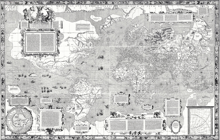
Mercator world map (1569) (See also Gerardus Mercator)

“Theatrum Orbis Terrarum” by Abraham Ortelius (1570)

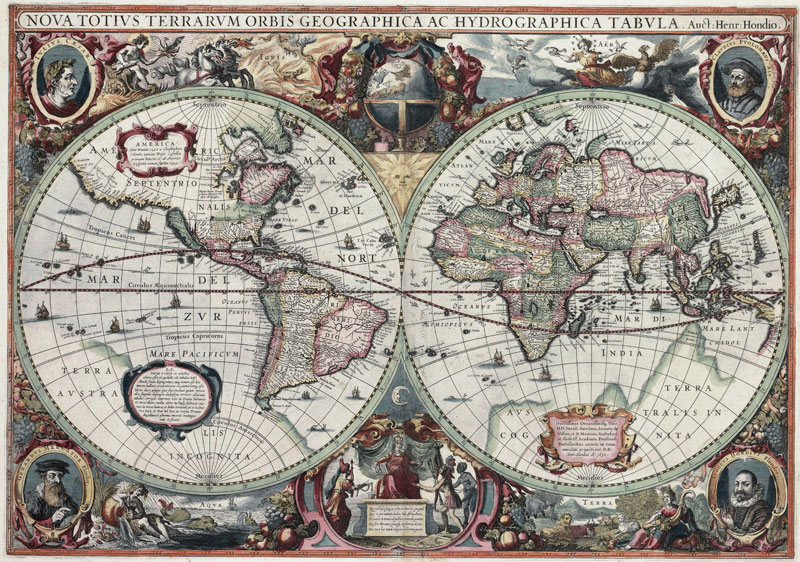
“Nova totius Terrarum Orbis” by Hendrik Hondius (1630)


Related Posts

  • Arabic Machines: Early Schematics

    Water powered systems, pulleys and gearing mechanisms, images from an arabic manuscript, datable from the…

  • Johann Leonhard Rost's "Astronomisches Handbuch" (1718)

    This is one the first (if not the very first) practical astronomy books published in…

  • Illustrations by Chiara Dattola

    A little selection of works by our friend Chiara, whom we've just met here in Paris.…

  • 20k Leagues

    Html 5 + Web fonts = the 1962 Atlantis World's Fair. (And be sure not…

  • 1937's exploding Hindenburg Zeppelin

    On romanoarchives.tk

Comments

  1. Carlos López Tascón says

    June 14, 2012 at 5:09 pm

    Para los que gustan de los mapas, creo que es una fantástica colección. Interesante ver la gran presisión de mapas de la era griega y romana, naturalemnte en su aproximación plana y reducido mundo euroasiático.

Trackbacks

  1. Como se imaginaban el mundo: Los primeros mapas y atlas says:
    June 14, 2012 at 7:46 pm

    […] "CRITEO-300×250", 300, 250); 1 meneos Como se imaginaban el mundo: Los primeros mapas y atlas   socks-studio.com/2012/06/10/how-the-world-was-imagine-ear…  por equisdx hace […]

  2. 13 Ways to Learn in 2013: The eLearning Coach says:
    January 3, 2013 at 5:53 pm

    […] beautiful old maps from some of these collections: University of Illinois for historical maps, How the World was Imagined, Panormaic Maps of Italian Cities and see the collection at Old Maps Online. When you’ve had […]

  3. 13 Τρόποι για να Μάθεις το 2013 | Speed Learning says:
    March 8, 2013 at 11:27 am

    […] συλλογή από παλιούς χάρτες στα sites  University of Illinois, How the World was Imagined, Old Maps Online και στη συνέχεια κατεβάστε το Google Earth για μία […]

  4. O Project Manager μαθαίνει… | PMP®Certification Prep seminars by Human Asset says:
    March 18, 2013 at 10:44 pm

    […] συλλογή από παλιούς χάρτες στα sites  University of Illinois, How the World was Imagined, Old Maps Online και στη συνέχεια κατεβάστε το Google Earth για μία […]

  5. JmeNash says:
    May 4, 2013 at 8:30 pm

    […] The World, 43 A.D. […]

  6. Mapmakers must Race to the End of the World, by A. L. Tait (book review) | BooksYALove says:
    July 15, 2017 at 5:00 pm

    […] lands, unknown dangers, commanded to map the whole world – ain’t on the farm […]

  7. The Mediterranean as Upside-Down Anteater – Andrew Hammel says:
    February 14, 2018 at 6:42 pm

    […] More historical maps here. […]

Leave a Reply

Your email address will not be published. Required fields are marked *

  • Instagram
  • Twitter
  • Facebook
  • Tumblr

Socks is a non-linear journey through distant territories of human imagination.

About | Visual Atlas | Topics

We are Mariabruna Fabrizi and Fosco Lucarelli from Microcities. Ask us anything

  • Instagram
  • Twitter
  • Facebook
  • Tumblr


SOCKS is a project by Fosco Lucarelli and Mariabruna Fabrizi of MICROCITIES, Architecture Cityscape, Landscape.
Except where otherwise noted, the content on this site is licensed under a Creative Commons Attribution-ShareAlike 3.0 license.
Whenever possible we try to attribute content (images, videos, and quotes) to their creators and original sources. Please feel free to write us if you notice misattributions or wish something to be removed.
SOCKS is powered by WordPress.