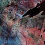
Tomnod, (after the Mongolian word for “Big eye”), is an interesting site in that it provides high resolution satellite maps and allows users from all over the world to tag them. A crowdsourcing system in research and satellite image scanning, the site has previously been used after Typhoon Haiyan hit the Philippines last November: during that campaign volunteers tagged over 60,000 objects of interest from satellite photos, information that the company then passed on to disaster relief teams. Apart from this, the site has already ben used in several other occasions, from the hunting for the tomb of Genghis Khan, to searching for lost hikers in Peru, to tracking the conflict in Damascus.
Tomnod uses images from five satellites and lets people scan through them on a specific search campaign helping to build a long tail for global search efforts. At the moment the site focuses on the search for the flight MH370 and lets users look for any hints of airplane wreckage, life rafts, oil slicks or “anything interesting or suspicious”.
To avoid false informations and tagging, Tomnod has developed an algorithm, known as CrowdRank, that helps filter the reliable sources and verifies the accuracy of individual contributors.
There is also a whole subreddit dedicated to the search for clues on the disappared flight MH370 on Tomnod.
 From Tomnod’s website: Examples of possible military buildings, crowds, landmarks and military vehicles in Damascus detected by Tomnod’s CrowdRank and derived from volunteer imagery insight.
Images via:


I tag a plane looking on your sight. There 5 tags but I of earliest one shows thr front end of plane under water withthe noes and part of window showing above the water. No one check it out