Eduard Imhof (1895 – 1986) was a professor of cartography at the Swiss Federal Institute of Technology, Zürich, from 1925 to 1965. His studies on relief shading were revolutionary: all the editions of the Schweizerischer Mittelschulatlas, and the Schweizerischer Sekundarschulatlas, the atlases used in Swiss high schools and primary school, published from 1932 until 1976 were under his direction.
His fame brought him to spend several weeks in a Tibetan monastery in 1930, in order to measure the height and position of Minya Konka and he made a journey to Ankara, Turkey, in 1951, to work for the Turkish Office for Land Surveying , and to make an ascent of Mount Ararat.
Here follows, in no particular and non-chronological order, a selection of early studies, sketches, reliefs shading paintings, panoramas, watercolours, model photos and model making techniques. (More resources at the end of the post)


Resources:
Virtual Library Eduard Imhof at ETHZ
Eduard Imhof entry at reliefshading.com
Schweizerischer Mittelschulatlas, blog entry at the wonderful Codex99.com
Shaded Relief Archive / Eduard Imhof (hi-res images)
Terrain Models / Eduard Imhof
Via: But Does it Float?
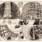
By chance I came across one of the schweizerisches sekundarschul atlas by Lehrmittel verlag. a second edition copy from 1937 and it is completely amazing. I have to say though, the drawing and images of the process shown here are a bit more interesting than the actual cartographic maps in the atlas, since they do not have all the overlayed information and colors.
I scanned a few images from it and posted them on my tumblr. Here is the link in case you are interested. http://deseopolis.tumblr.com/post/104026676935/ginebra-basilea-zurich-berna-schweizerisches (you have to right click and open in new tab for better quality)
Thank you, they are amazing maps, but you’re right: the process looks even more interesting than the result.
Great maps !