SOCKS

An online magazine of Art, Architecture, Media, Culture, Sounds, Territories, Technology)

  • Media
  • Art
  • Architecture
  • Culture
  • Sounds
  • Territories
  • Visual Atlas

Pirro Ligorio’s “Antiquae Urbis Romae Imago” (Image of the Ancient City of Rome), 1561

March 13, 2016 by Mariabruna Fabrizi 1 Comment

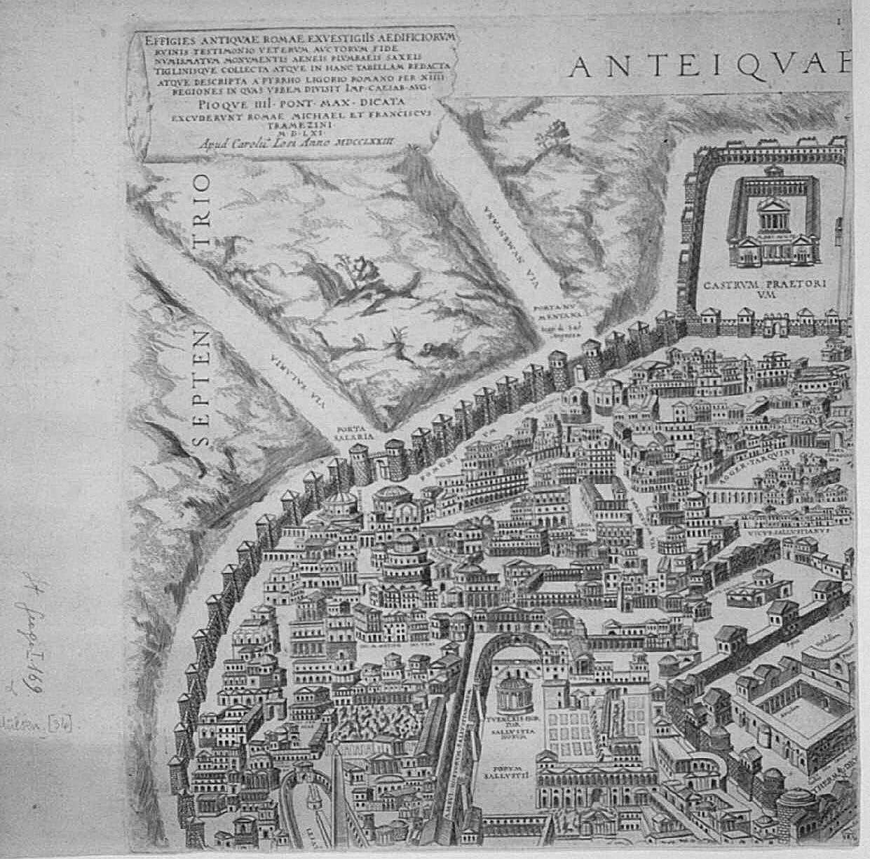
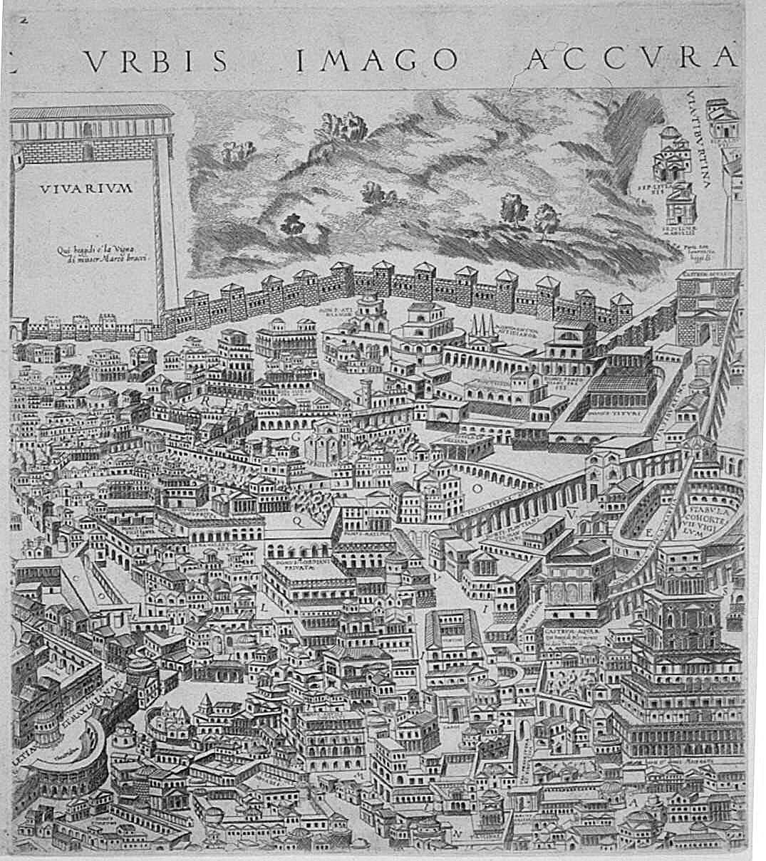
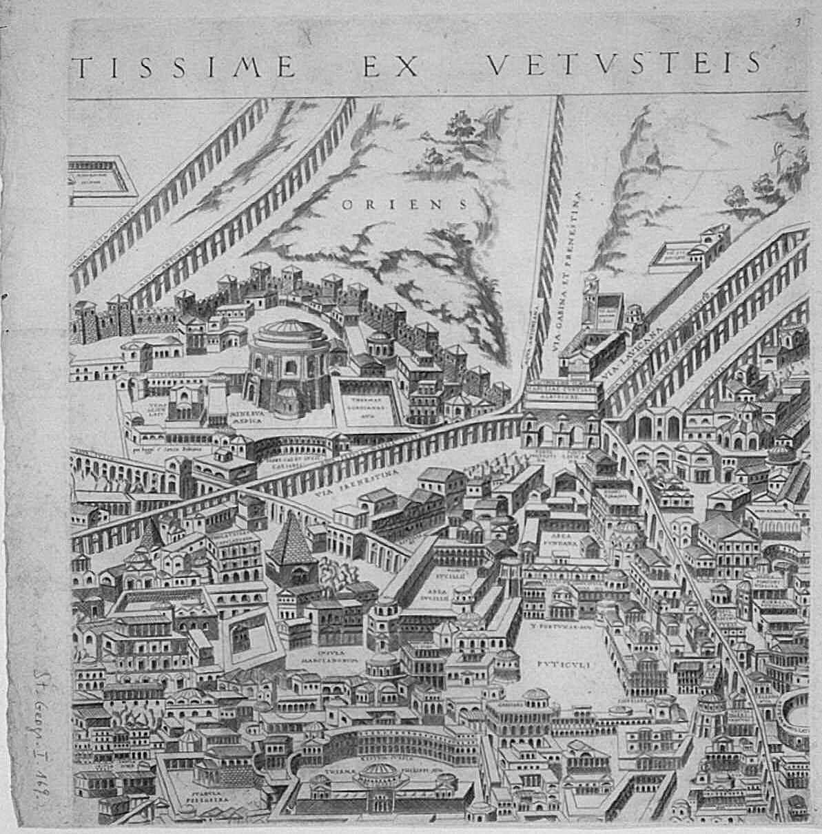
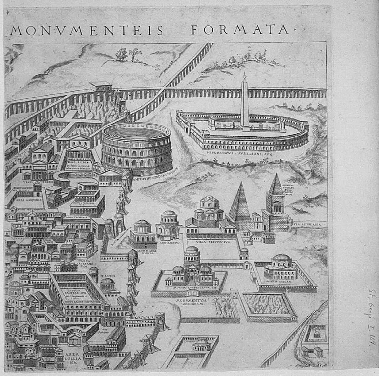
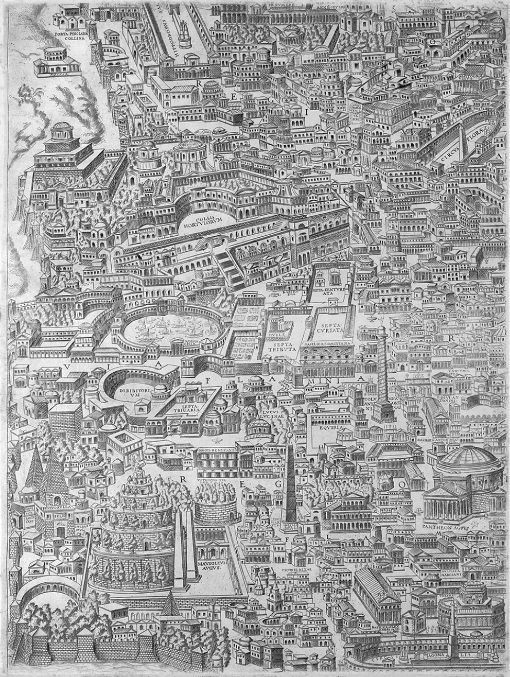
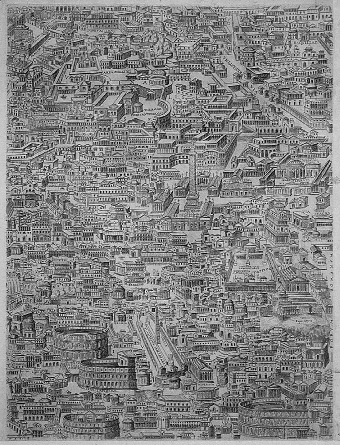
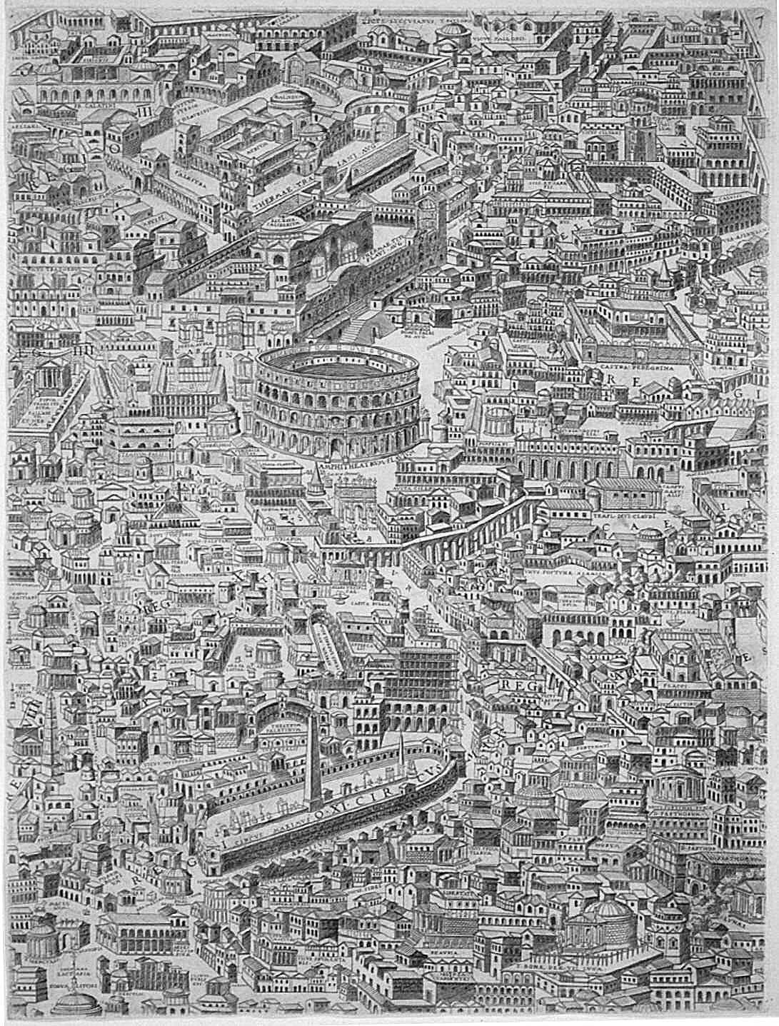
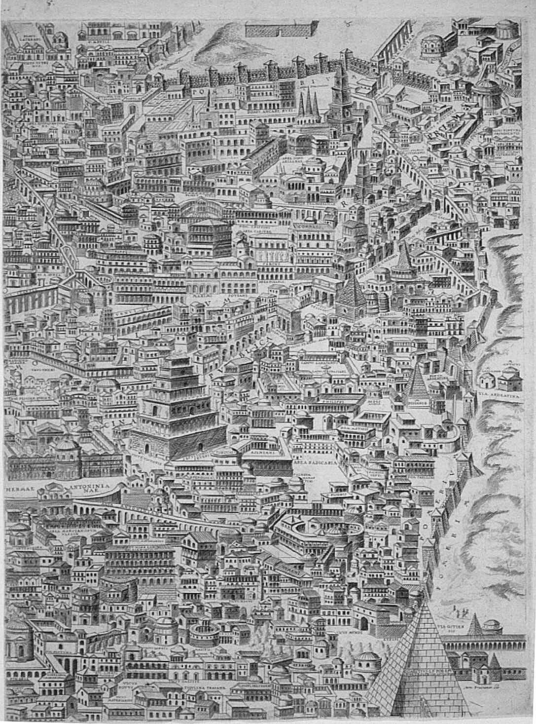
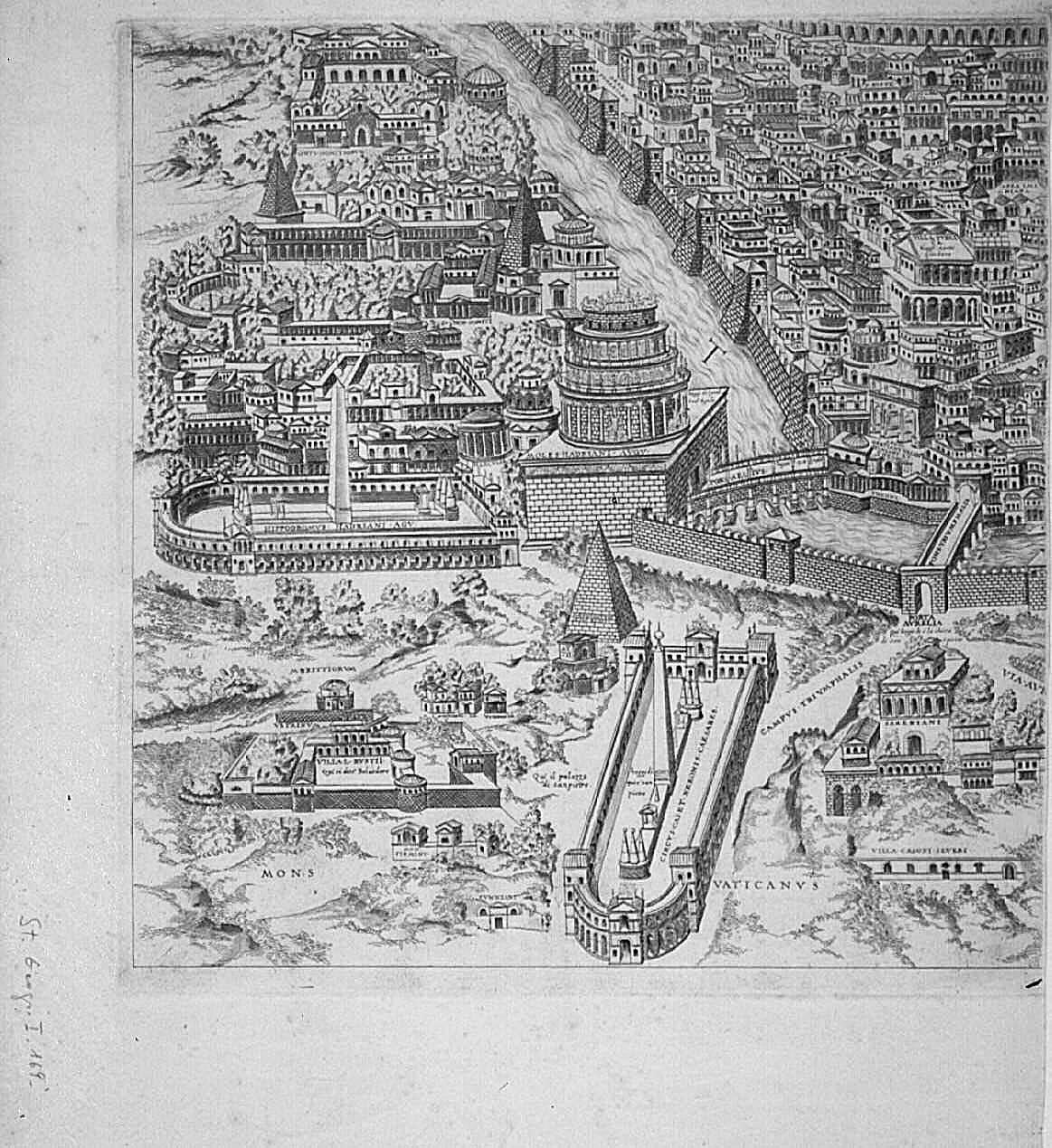
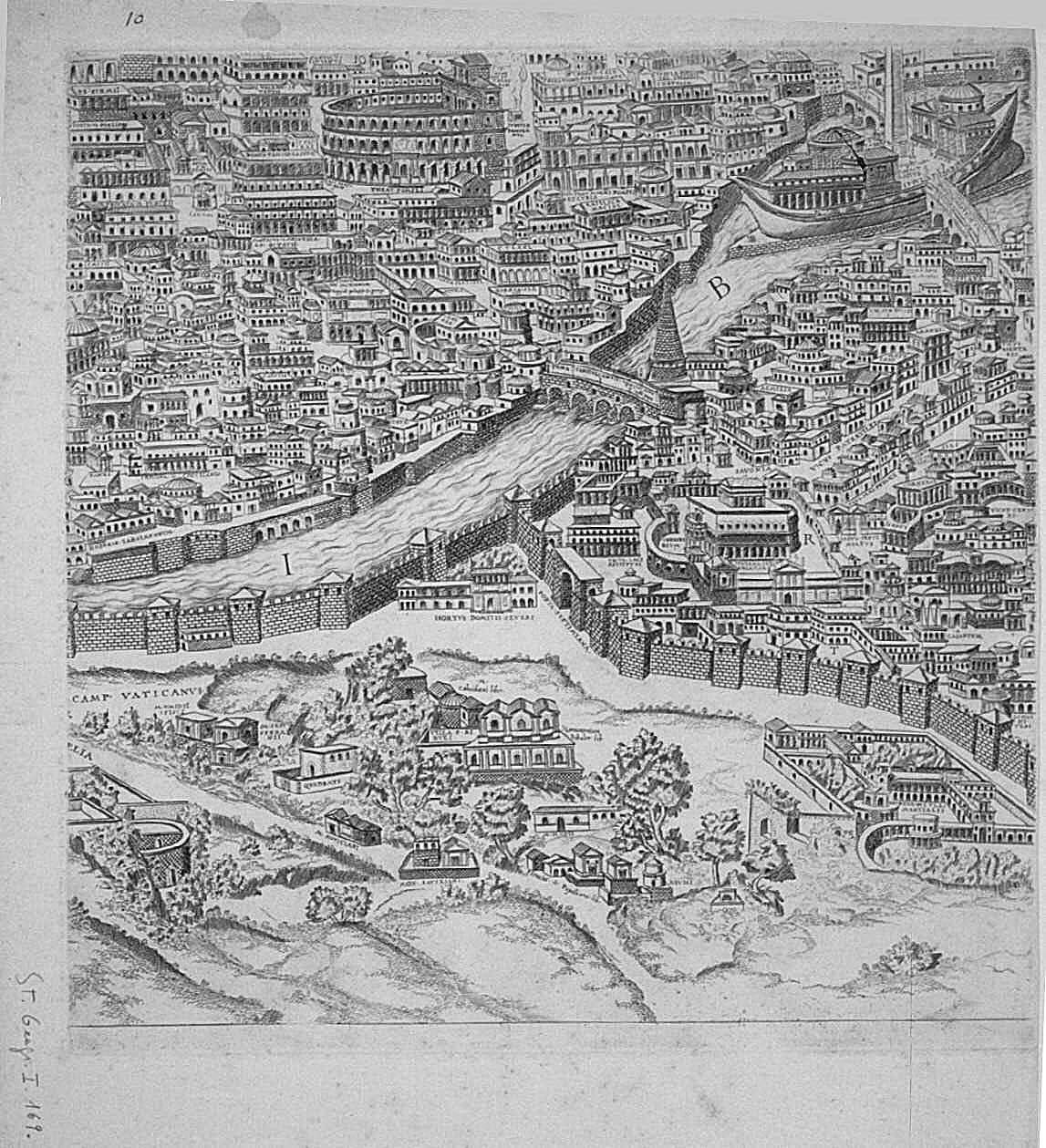
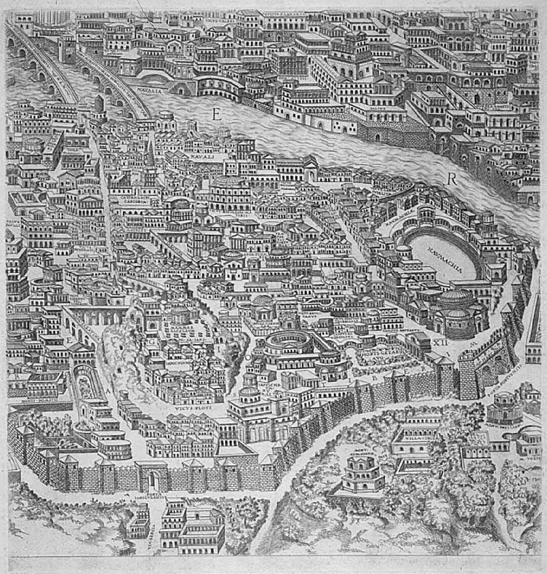
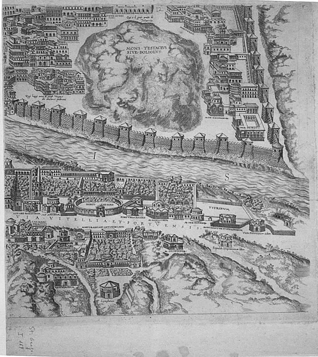
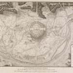
In 1551, Pirro Ligorio produced an engraving depicting a reconstruction of ancient Rome; this inventive map was printed by Jacopo Rossi in 1561. Pirro Ligorio was an architect, a painter, a counterfeiter and a scholar who studied and researched the ancient ruins of the city of Rome as well as classical literary sources, fragments and antique inscriptions in order to produce his detailed bird’s-eye view of the ancient city. The ‘Antiquae Urbis Romae Imago accuratissime ex vetustis monumentis formata‘ is an imaginative reconstruction of the city of Rome during the Imperial Age where the distances between the monuments are filled with ordinary houses and buildings.The map synthetizes compositional inventions with the research for archeological accuracy and exploits the perspective view in order to confer an expressive force to the single monuments, a character which is revealed in this map as more important than topographical accuracy.


pirro-01


pirro-02


pirro-03


pirro-04


pirro-05


pirro-06


pirro-07


pirro-08


pirro-09


pirro-10


pirro-11


pirro-12


Further info and source at ibiblio

Open a fully zoomable map here at Gallica, or at bsrdigitalcollections.

Related Posts

  • The Round City of Baghdad

    The first nucleus of the city of Baghdad was the "Round City" (Madinat al-Salam) founded…

  • The Ideal City of Chaux by Claude-Nicolas Ledoux (1773-1806)

    In 1789, during the Revolution and specifically during his imprisonment, architect Claude-Nicolas Ledoux started the…

  • Hashimoto Okiie's Views of Ancient Castles and Gardens / 1

    Hashimoto Okiie ( 1899- 1993) was a Japanese woodcut artist. After working as a teacher and…

  • "A Roman State of Landscape". Exhibition and talk at Campo, Rome - June, 23rd 2016

    If you are in Rome today, do not miss: A ROMAN STATE OF LANDSCAPE Exhibition…

  • Alvin Boyarsky, Chicago à la carte, The City as an Energy System (1968)

    This post introduces a series of heterogeneous articles on Chicago, the city and its architecture:…

Comments

  1. Paul Brinkmann says

    May 18, 2016 at 2:31 pm

    Dear Mariabruna Fabrizi,

    Searching after how Temple Minerva Medica around 1620 on the Esquilyn has been situated relative to the different aquaducts then, I discoverd this website.
    How can I discover the plan of that part of Ancient Rome with a good quality of pictures?
    In advande thanks very much

    Paul Brinkmann, the Netherlands

Leave a Reply

Your email address will not be published. Required fields are marked *

  • Instagram
  • Twitter
  • Facebook
  • Tumblr

Socks is a non-linear journey through distant territories of human imagination.

About | Visual Atlas | Topics

We are Mariabruna Fabrizi and Fosco Lucarelli from Microcities. Ask us anything

  • Instagram
  • Twitter
  • Facebook
  • Tumblr


SOCKS is a project by Fosco Lucarelli and Mariabruna Fabrizi of MICROCITIES, Architecture Cityscape, Landscape.
Except where otherwise noted, the content on this site is licensed under a Creative Commons Attribution-ShareAlike 3.0 license.
Whenever possible we try to attribute content (images, videos, and quotes) to their creators and original sources. Please feel free to write us if you notice misattributions or wish something to be removed.
SOCKS is powered by WordPress.