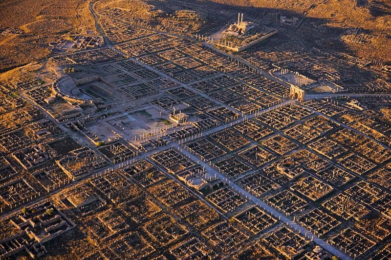
The city of Timgad, in today’s Algeria, was founded as a military settlement by Emperor Trajan around AD 100 and its original scope was to be a defensive bastion against the Berber invasions. The city had a peaceful existence for the first centuries of its life, but was sacked by the Vandals in the 5th century and consequently fell into decline. After a Byzantine reconquest in the 6th century, the city lived a new period of splendor only to be interrupted by the invasions of the Arabs in the 8th century and the consequent full abandon.
The ruins of the city were well preserved under the sands of the Sahara and have been excavated for the first time only in 1881.
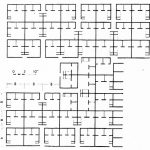
Founded as a perfect square with 355m sides, Timgad is orthogonally intersected by the Decumanus Maximus and the Cardus Maximus both originally marked by a Corinthian colonnade. The town was initially planned to host 15,000 people, and its first inhabitants were mostly veterans who received land after their service. Over the centuries the city grew considerably until reaching four times its original size. The newly added neighborhoods didn’t follow the first planning scheme.

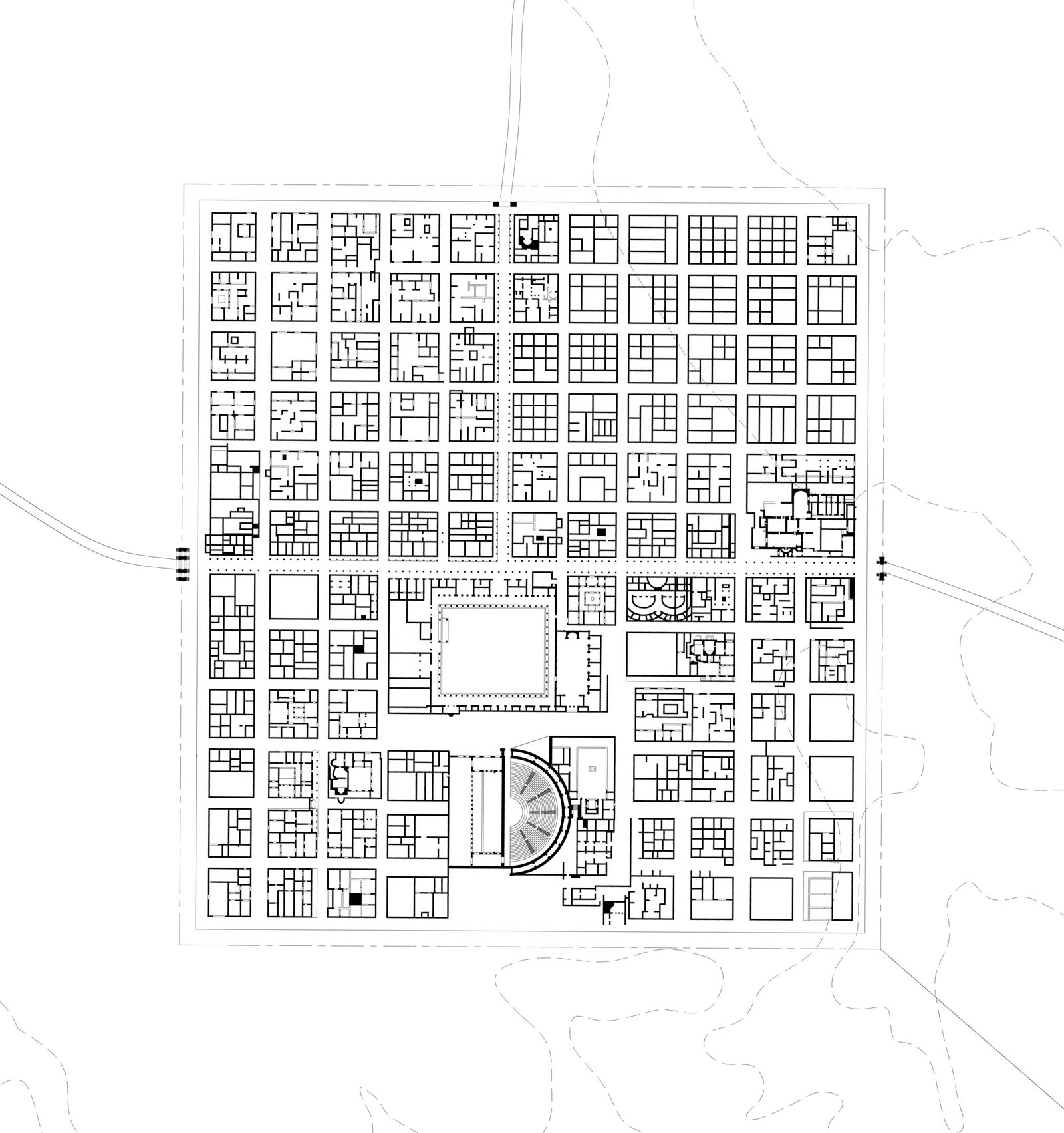 Image by Frederik Pöll
The original square of the town was divided into small insulae, mostly residential and commercial, all of the same dimensions of around 70 by 70 Roman feet (21 by 21 m) and each one including one or more houses. When the excavation occurred, eight insulae, at the intersection of the cardus and the decumanus, were occupied by the Forum, one was occupied by the market, four by the theatre, seven by baths of different sizes, one by a public library, and one by a Christian church and two by temples.
 Photographer unknown
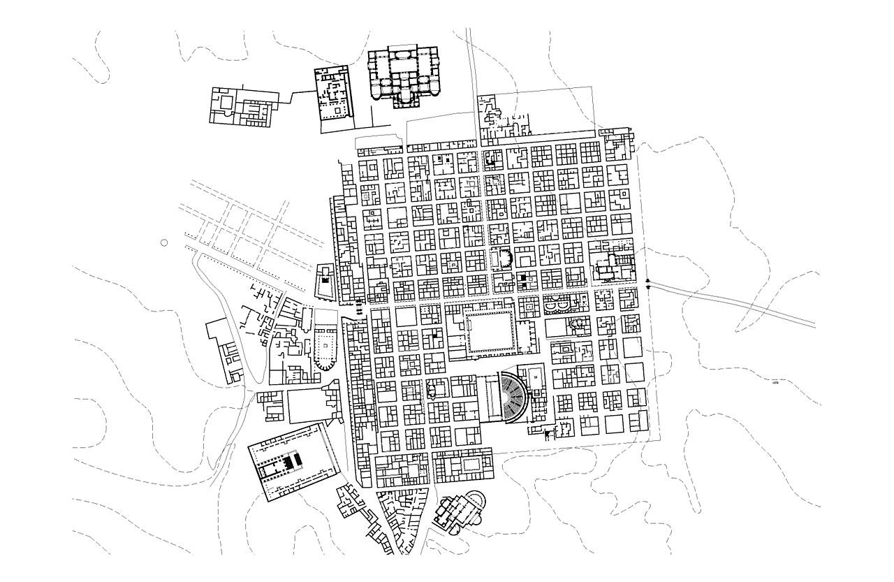 Image by Frederik Pöll – https://commons.wikimedia.org/wiki/File:Timgad_-_Expansion_in_2nd_and_3rd_Century.jpg
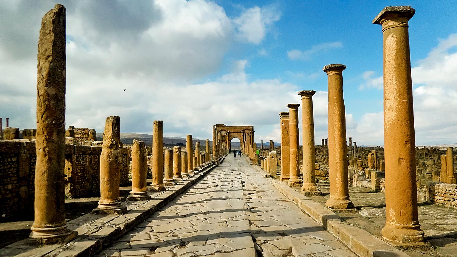 Photo by Habib kaki – https://commons.wikimedia.org/wiki/File:Timgad_%D8%AA%D9%8A%D9%85%D9%82%D8%A7%D8%AF_4.jpg
Further reading:
Albert Ballu, Les ruines de Timgad, antique Thamugadi : sept années de découverte (1903 – 1910)
Boeswillwald ; Cagnat; Ballu, Timgad: une cité africaine sous l’Empire Romain — Paris, 1905


Leave a Reply