SOCKS

An online magazine of Art, Architecture, Media, Culture, Sounds, Territories, Technology)

  • Media
  • Art
  • Architecture
  • Culture
  • Sounds
  • Territories
  • Visual Atlas

Michelangelo Caetani’s Six Topographic Maps of the Divine Comedy

April 24, 2022 by Fosco Lucarelli Leave a Comment

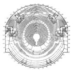
As a follow up to the latest post on Norman Bel Geddes’s stage set design for Dante Alighieri’s Divine Comedy, here we feature the six maps drawn by Michelangelo Caetani in a book titled La materia della Divina Commedia di Dante Alighieri dichiarata in VI tavole, Roma (1855).

A duke and a politician, Caetani was well versed in drawing and fine arts and as a respected intellectual, his house in Rome was a meeting place for international scholars. As Dante’s scholar, he published relevant interpretative works on the trecento author and designed six topographic maps in multiple colours to be used by students of the Divine Comedy.

Michelangelo Caetani, The Divine Comedy Described in Six Plates 1855. Cover

Overview of the Divine Comedy, 1855(Plate I)

The Ordering of Hell, 1855 (Plate II)

Map of Hell and Dante’s itinerary, 1855 (Plate III)

Cross Section of Hell, 1855 (Plate IV

The Ordering of Paradise, 1855 (Plate VI)

All images are in Public Domain. Collection: Cornell University Library, Division of Rare & Manuscript Collections: Persuasive Cartography: The PJ Mode Collection.

Related Posts

  • 250mb of old maps of South London

    Maps dating back to the 16th century, free for downloading. Here. Londini Angliae Regni Metropolis…

  • Stage Design as a Narrative Device: Norman Bel Geddes’ Stage Set for The Divine Comedy (1921)

    American stage and industrial designer, director and producer Norman Bel Geddes (1893-1958) worked on a…

  • Stanley Tigerman, Six Planar Forms with Columns, Walls, Buttresses

    Click to zoom. Via: zuloark found

  • City Maps by Jazzberry Blue

      Jazzberry Blue is an an artist and illustrator based in Toronto. Among his rich…

  • Stephen Walter’s Maps

    Stephen Walter's maps are the result of an intersection of signs and symbols. In Walter's…

Leave a Reply

Your email address will not be published. Required fields are marked *

  • Instagram
  • Twitter
  • Facebook
  • Tumblr

Socks is a non-linear journey through distant territories of human imagination.

About | Visual Atlas | Topics

We are Mariabruna Fabrizi and Fosco Lucarelli from Microcities. Ask us anything

  • Instagram
  • Twitter
  • Facebook
  • Tumblr


SOCKS is a project by Fosco Lucarelli and Mariabruna Fabrizi of MICROCITIES, Architecture Cityscape, Landscape.
Except where otherwise noted, the content on this site is licensed under a Creative Commons Attribution-ShareAlike 3.0 license.
Whenever possible we try to attribute content (images, videos, and quotes) to their creators and original sources. Please feel free to write us if you notice misattributions or wish something to be removed.
SOCKS is powered by WordPress.