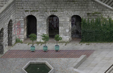
In 1980, German architect Oswald Mathias Ungers took part in a competition for a prototypal solar house to develop on a large scale in the community … [Read more...]
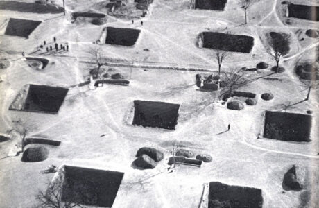
Living Inside the Earth: the Yaodong, cave buildings in China
The Yaodong (窑洞) is a type of architecture developed in the Loess Plateau in the north of China. The name literally means “cave building” and … [Read more...]
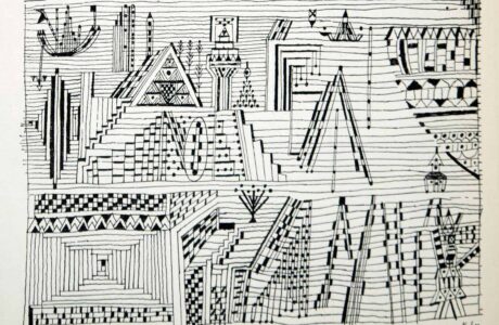
Linear Analogies: a Selection of Paul Klee’s Black and White Lithographies
In the multiple explorations of form and composition by German-Swiss artist Paul Klee, a special place is occupied by works where the line is the main … [Read more...]
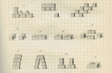
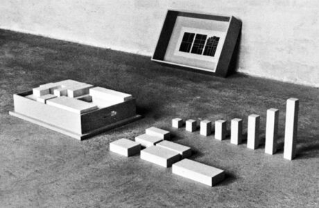
Understanding Reality through Wooden Blocks: Froebel Play Gifts
Friedrich Froebel (1782-1852) was a German educator, considered as the inventor of the Kindergarten in 1837, at first named “Play and Activity … [Read more...]
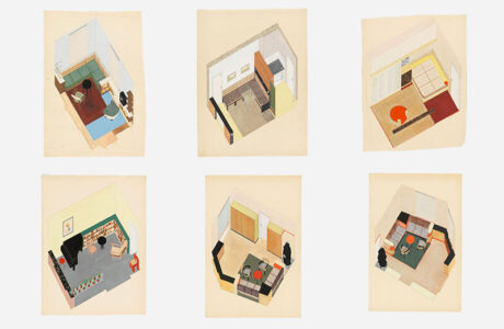
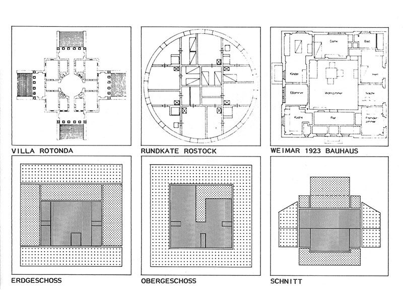
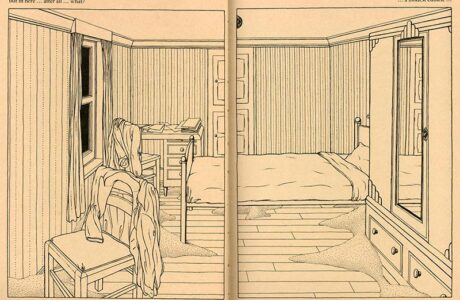
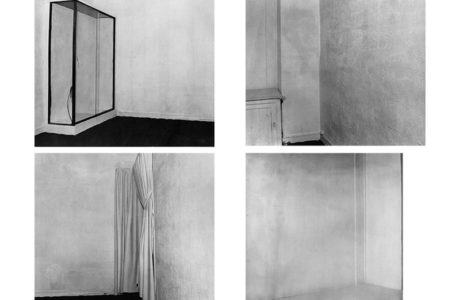
Margarete Fröhlich. Axonometric Explorations of Rooms
Margarete Fröhlich (1901-2001) was an Austrian artist and interior designer who specialised in the modelling of housing units. Initially, she studied … [Read more...]
“The process I use has nothing at all of that of an ‘artist’ nor does it have anything in common with an ‘artistic gesture’”. Dom Hans van der Laan’s Plastic Number
Dutch Benedictine architect and monk Dom Hans van der Laan (1904–1991) developed his body of work on the base of a system of proportions he had … [Read more...]
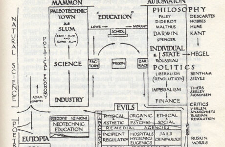
From Vision to Knowledge: Patrick Geddes’ Outlook Tower (1892)
Scottish geographer, biologist, sociologist and town planner Patrick Geddes bought a tower next to the Edinburgh Castle in 1892. In over 20 years, he … [Read more...]
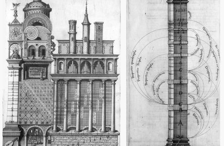
Architecture as a Mnemonic Device: Robert Fludd’s Temple of Music
English physician and polymath Robert Fludd (1574-1637) had interests spanning from scientific knowledge to occult disciplines. His approach to … [Read more...]
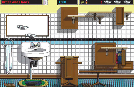
The Section as an Interior Landscape: Glider, a videogame by John Calhoun (1988-1994)
Video game developer John Calhoun published Glider in 1988. The whole Macintosh video-game is structured on the section of a house with a series of … [Read more...]
“Its unfinished decoration in danger of slipping beneath the eye to hurtle wildly across the crumbling walls.” The Cage, a Visual-Novel, by Martin Vaughn-James (1975)
Wonderful online archive UbuWeb, created in 1996 by conceptual artist, poet and theorist Kenneth Goldsmith (author of many books among which Duchamps … [Read more...]
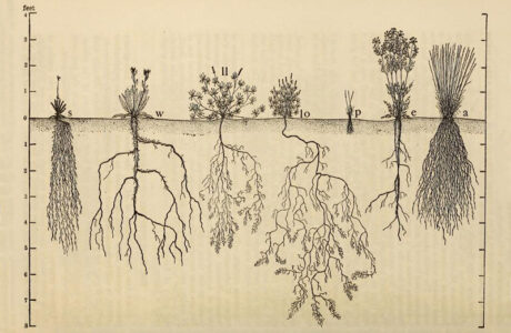
Patterns from the World Underneath: The Ecological Relations of Roots by John Ernest Weaver (1919)
The ecological relations of roots (1919) is a book by John Ernest Weaver (1884 – 1966), an American biologist and prairie ecologist. During his life, … [Read more...]
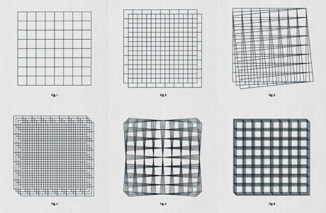
Ryan Carl, Grid Forms Study 02 (2020)
After Circle Study 07, the second work by designer Ryan Carl that we feature here on Socks is a sequence of geometric operations on grid forms … [Read more...]
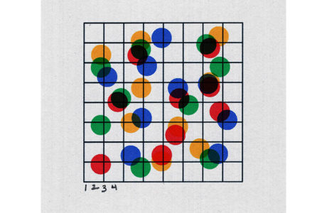
Ryan Carl, Circle Study 07 (2020)
The work of Ryan Carl is "rooted in radical simplicity". A designer who studied religion and philosophy before opening his practice, Ryan Carl delves … [Read more...]
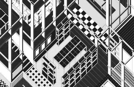
The Architecture of the Workspace: Axonometric Drawings by Peter Judson
Peter Judson is a British designer and illustrator. (Already featured, on Socks). For his project "Hyundai card", commissioned by design studio … [Read more...]
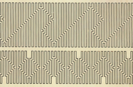
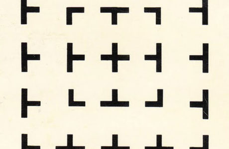
An Exercise in Constraints: Drawings by Wacław Szpakowski (1883-1973)
Wacław Szpakowski was a Polish architect, engineer and artist. Starting at seventeen years old and throughout his whole life, he developed a series of … [Read more...]
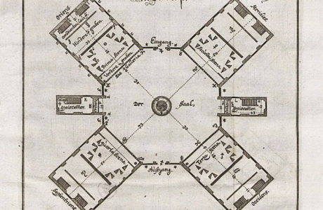
The Theatre as Machine: Joseph Furttenbach Stage Design
Joseph Furttenbach (1591 – 1667) was a German architect, engineer and architecture theorist who lived in Italy from 1610 to 1620. During his stay … [Read more...]
Axonometric Realism: “Hortus Conclusus” by Beate Gütschow (2019)
Beate Gütschow is a German contemporary artist who works primarily through photography. In her work, she analyses the complex and ever-changing … [Read more...]
A Visual Thinking Strategy: Oswald Mathias Ungers, Morphologie: City Metaphors (1982)
German architect Oswald Mathias Ungers (1926–2007) accompanied his life-long architectural and theoretical production with a parallel work on found … [Read more...]
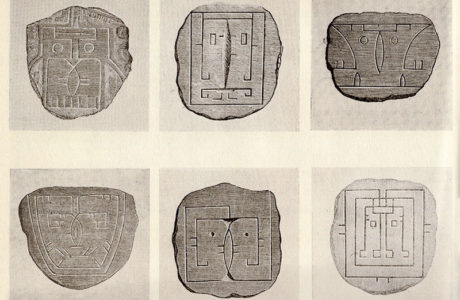
Symbolic Truth: Geometric Portraits by Indigenous Populations from Brazil.
Founded by Lina Bo and her husband Pietro Maria Bardi in 1950, the Brazilian magazine Habitat ("The magazine of the arts in Brazil") manifested a … [Read more...]
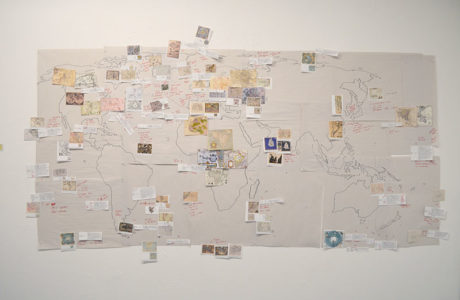
Mapping Fictional Realms: “Terram in Aspectu” by Liliana Farber (2019)
New Media artist Liliana Farber investigates the ways in which the virtual redefines the physical world. Using custom-made software and collected … [Read more...]
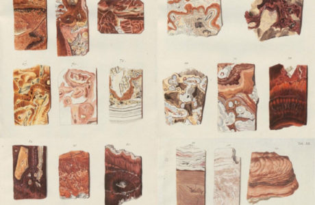
Color Schemes from Geology. A Work by Uibelakers (1781)
Franz Uibelakers was a German mineralogist. In his work, “System des Karlsbader Sinters” (1781) he presented sections of stalactites and stalagmites … [Read more...]
Mary Ellen Solt, Moonshot Sonnet (1964)
The Moonshot Sonnet is a concrete poem composed in 1964 by poet Mary Ellen Solt (1920-2007). The work is a poem created reformatting diagrammatic … [Read more...]
Two Exhibitions at Iris Clert Gallery, Paris: Yves Klein’s Le Vide (The Void, 1958) and Arman’s Le Plein (The Full-Up, 1960)
Recently my work with color has led me, in spite of myself, to search little by little, with some assistance (from the observer, from the translator), … [Read more...]
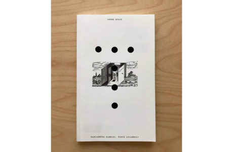
Inner Space (The Book)
We present Inner Space, an essay we have written in connection to the curatorship of the homonymous exhibition at the 2019 Lisbon … [Read more...]
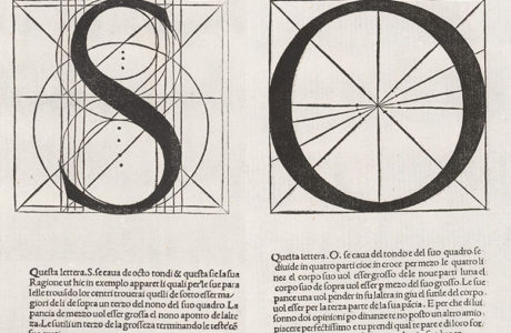
The Underlying Structure of Letters: Luca Pacioli’s Alphabet from De Divina Proportione (1509)
Franciscan friar and mathematician Luca Pacioli wrote several books on mathematics and geometry. Among them, in 1497, Pacioli conceived De Divina … [Read more...]
- « Previous Page
- 1
- 2
- 3
- 4
- …
- 41
- Next Page »